
FIELD-TO-FINISH SOFTWARE SUITE
Post-Processing & Survey CAD Software
GNSS static baseline post-processing, 3D network adjustment, and CAD mapping software.
⚡ 1 Premium Products📡 ISRO NavIC + Multi-Constellation🎯 Sub-Centimeter Precision
GNSS Post-Processing Software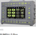
SOFTWARENavIC + GPS
Justin 3
Advanced GNSS static baseline post-processing, 3D network adjustment, and precise orbit analysis software.
Read Product DetailsEXPERT TECHNICAL ADVICE
Request Technical Consultation →Need Assistance Selecting the Right GNSS Receiver?
Our senior geospatial engineers will help you choose the ideal RTK rover, smart antenna, or CORS base station for your project requirement.